
Poway ZIP Codes and Their Uses
Poway has one documented ordinary street-delivery ZIP and a separate postal use for boxes. The distinction is the center of any Poway ZIP code directory. Physical City Hall and the Poway Library use street addresses in the ordinary delivery range. City mail also uses a post office box address in the other ZIP. That does not establish two equal residential zones, and it does not prove that a postal line follows the incorporated city edge.
| ZIP Code | Areas Covered or Used | Post Office | Notes |
|---|---|---|---|
| 92064 | Ordinary Poway street delivery, including central, north, east, and south residential and business areas within postal coverage | Poway Post Office or station, confirm in USPS locator | Only regular street-delivery ZIP verified for the city |
| 92074 | Poway post office boxes, including City PO Box 789 | Poway postal facility | PO-box ZIP, not a residential neighborhood roll |
No official ZIP split or realignment year was verified in the reviewed sources. A historic claim about a new boundary needs a dated postal directory, local newspaper, or postal record. Current delivery should be checked address by address instead of inferred from a map of the city.
92064 Carries Ordinary Poway Street Delivery
92064 is the ordinary street-delivery ZIP documented for Poway. City Hall and the Poway Library use 92064 street addresses, and the city’s major roads, business areas, and residential parcels are reached through ordinary postal delivery in that range. Postal coverage still describes routing. It does not certify that an address lies inside the legal city line, that the parcel belongs to Poway government, or that a person lives there.
For a ZIP code directory search, treat 92064 as a way to narrow a mailing clue, then confirm the street and physical parcel. PowGIS can place an address against parcel geometry, zoning, council district, and city layers. ParcelQuest Lite can add APN, assessed values, characteristics, and maps. The two systems work from address or parcel information, not from a verified ZIP-wide list of people.
Poway’s long roads and subdivision history make this check important. A postal city name can remain stable while land was once rural, was later subdivided, or sits near a jurisdiction line. The ZIP code helps route the first inquiry. The parcel and jurisdiction layers determine which office holds the next record.
92074 Serves Poway PO Boxes
92074 appears in the official City of Poway mailing address PO Box 789, Poway CA 92074-0789. That concrete example shows why a ZIP code directory must separate a box route from ordinary street delivery. A 92074 line can identify where correspondence is received without identifying a residential parcel, a street, or a person’s physical location.
Mailing and situs are different records concepts. A mailing address can be a post office box, an agent’s address, a trust address, or an address selected for correspondence. The situs is the property’s physical location. When a search begins with 92074, use the postal clue to locate the correct office or recipient route, then seek the physical address through a source that actually records it.
No evidence in the reviewed sources supports treating 92074 as a second ordinary residential neighborhood ZIP for Poway. It is safer to describe it as a PO-box use and verify any particular address through USPS rather than assigning a neighborhood from the five-digit code alone.
USPS Verifies a Poway ZIP Address
USPS address verification is the right first step when a postal code, postal city, or ZIP+4 is uncertain. Enter the complete street address and compare the returned delivery format with the source record. A postal result can correct a mistyped number, distinguish a box from a street route, or show that a mailing label needs a different ZIP. It cannot decide whether the location is inside Poway’s incorporated boundary or which agency owns a permit file.
The USPS address-to-ZIP lookup is the source behind the captured verification screen used for this ZIP code directory.
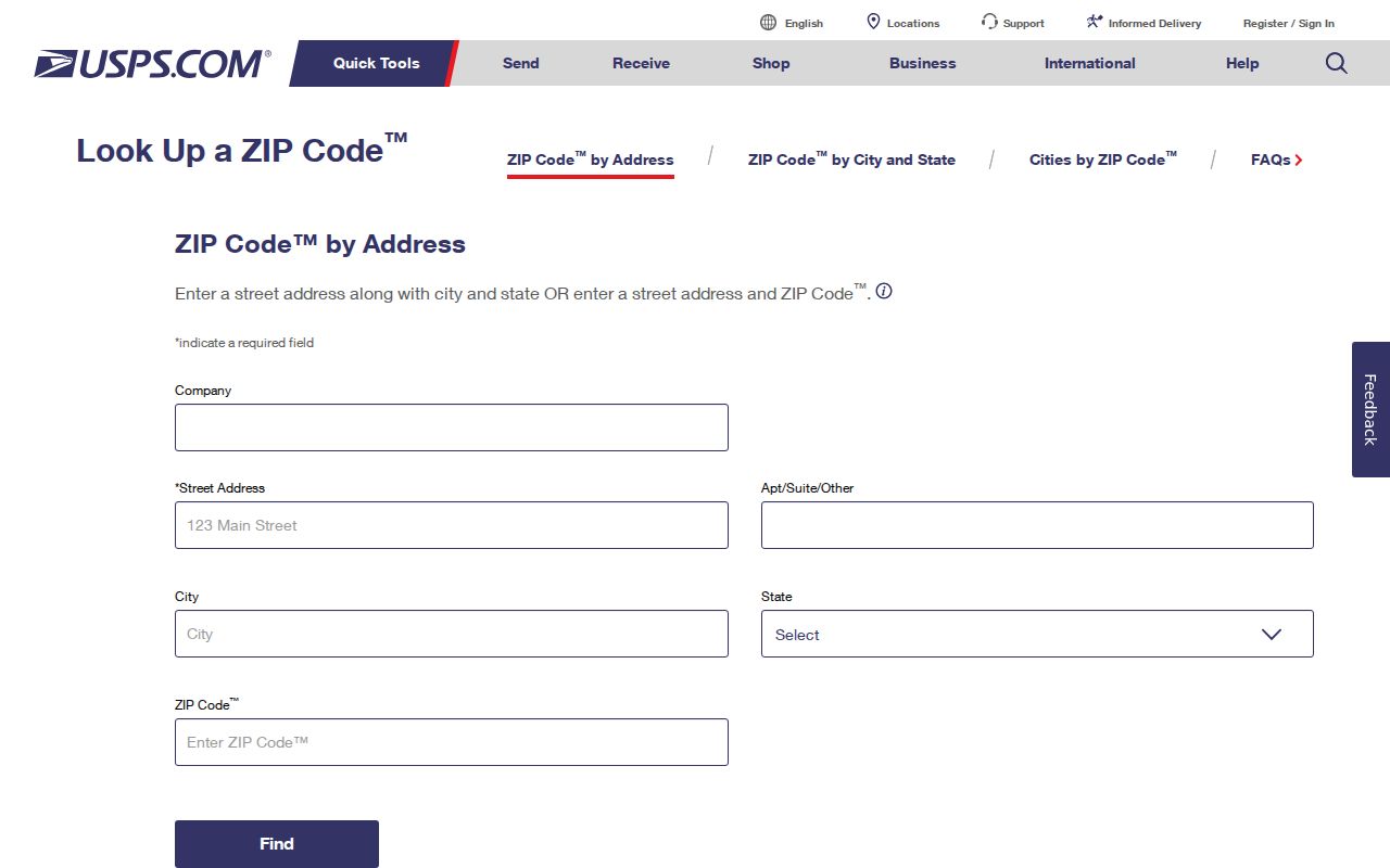
The screen is useful because it checks a complete address rather than guessing from a city name. Keep the returned format with the research note, including whether the address is street delivery or box mail. A USPS match is a routing confirmation, not proof of ownership, residency, or city jurisdiction.
There is no verified ZIP split year in the local research. If an older family letter, directory, or deed uses a different postal form, record the exact source date and search the historical material rather than inventing a realignment explanation.
Finding Poway Residents by ZIP Code
Finding residents by postal area in Poway requires a staged search because no official local portal was verified to return every parcel or person by ZIP. The name-and-phone search box can start a person-focused inquiry, but it does not convert a postal code into an official resident roll. Public local tools are strongest when a ZIP is used to verify an address and the exact record type is then chosen.
- Verify the full address and ZIP with USPS. Keep the returned street or box format and note any correction.
- Use PowGIS with the site address, road name, APN, intersection, or owner field. Do not assume a ZIP filter exists in the advanced parcel query.
- Use ParcelQuest Lite with an address or APN for parcel characteristics, assessed values, and maps. Ownership help is also available by county phone or kiosk.
- For a named person, compare the proper official source, such as a deed, permit, court index, business filing, or a self voter-status result. A ZIP alone cannot resolve same-name records.
- Once a physical street is known, follow the address chain in the Poway street directory workflow rather than treating the ZIP as the final search key.
This sequence preserves the distinction between a delivery area and an evidence trail. It also avoids claiming a ZIP-wide people search that the local research did not verify.
PowGIS Has No Verified Poway ZIP Field
PowGIS is valuable for ZIP research, but the official help does not confirm a dedicated ZIP field in its parcel query. Standard search accepts an address, road, parcel number, owner name, or intersection. Advanced parcel selection supports map shapes, field operators, and multiple clauses. The evidence supports using those known fields to locate a parcel, then comparing the USPS result, not inventing a ZIP-wide mode.
| Site Address | Documented PowGIS address entry and autocomplete. |
|---|---|
| Road name | Documented general search term for finding a street or road feature. |
| APN or parcel number | Documented search term for a tax-map parcel identifier. |
| Owner name | Documented parcel query field in advanced mode, subject to the portal’s actual result display. |
| Intersection | Documented general search term for map placement. |
| ZIP-wide resident field | No verified local public field or people-search result was found in the reviewed official help. |
PowGIS can display parcel reports, zoning, drawings, aerial history, and selected map results. ParcelQuest Lite is address and APN oriented. Neither source was verified as a ZIP-wide resident search, and the California voter self-lookup is not a ZIP browse.
A postal directory is therefore best used as a routing aid and a way to sort address notes, not as a substitute for a street, parcel, deed, or custodian search.
Poway Situs, Mailing, and Legal Description
Three address terms keep a Poway ZIP code directory from mixing postal and land records. A situs is where the parcel physically sits. A mailing address is where an owner, agency, or city receives correspondence. A legal description identifies the land by lot, block, tract, or metes-and-bounds language. The code belongs to the postal route, not to the legal identity of the parcel.
- Situs address
- The physical address used by mapping, assessment, permits, and other location-based records.
- Mailing address
- The address selected for correspondence. It may be a post office box or may point away from the situs.
- Legal description
- The recorded land description that controls the parcel identity when a street number or road name changes.
- ZIP versus ZIP+4
- The five-digit ZIP routes mail to a broad delivery area. ZIP+4 adds four digits for a more specific delivery segment, but neither establishes city limits.
- PO-box ZIP
- A ZIP used for post office box mail. 92074 is documented in Poway for that use and should not be treated as a street-neighborhood roll.
- Carrier route
- A postal delivery grouping within a ZIP. It describes carrier work, not ownership, residency, or a government jurisdiction.
A unique ZIP would be assigned to one institution or delivery point, but no Poway unique ZIP was verified in the reviewed sources. The absence of a verified field or special route is a reason to check the source, not to fill the gap with a guess.
ZIP Boundaries and Poway City Limits
A ZIP boundary is a postal routing line, while a city limit is a legal and governmental boundary. They can overlap without matching. A “Poway” postal label may extend beyond the incorporated city, and a property near the edge may use a postal wording that does not identify the agency holding its permit or assessment record. PowGIS, city boundary layers, council districts, and county jurisdiction are the better checks for that question.
The Poway redistricting and district map information illustrates a civic geography layer that is different from postal delivery.
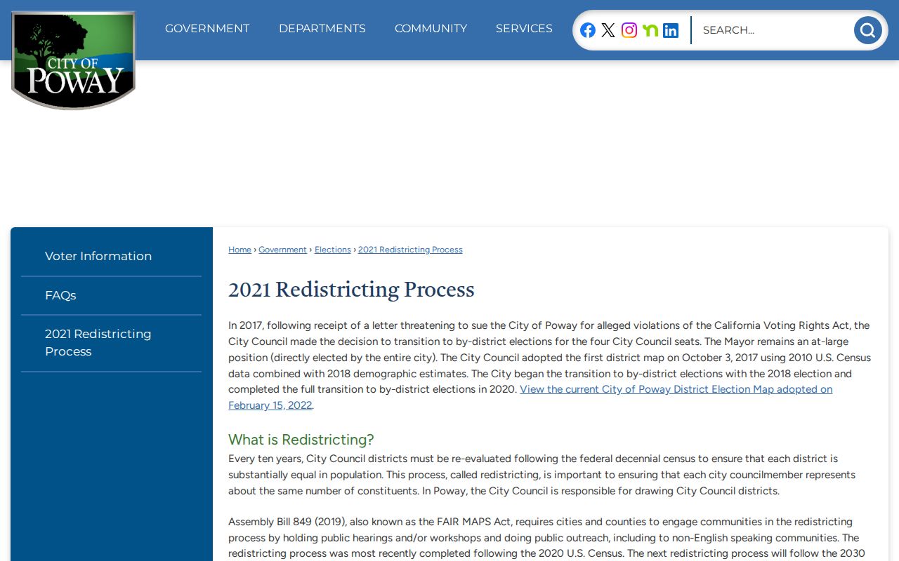
District boundaries can be paired with parcels and maps to understand city administration. They do not turn a ZIP into a neighborhood directory. When an address has a Poway postal city but appears outside a city layer, check the parcel, county, and service jurisdiction before requesting records.
Boundary check. Postal routing answers where mail goes. PowGIS and the county record map answer which parcel and jurisdiction hold the next public record.
Pre-1980 Poway Records Follow County Jurisdiction
Poway was unincorporated until December 1, 1980. That incorporation date is more useful for records routing than a postal label. Earlier election, permit, and governmental material generally belongs to San Diego County. Later city-created permit, code, council, business, and GIS files begin with Poway City Hall. Land title, assessment, vital records, voter registration, court cases, and custody records remain county or state functions.
The local record story also runs from an agricultural valley through late-1950s subdivision growth. An old letter with a Poway postal name may describe a rural place before the modern address system was complete. For a prior property or family search, pair the postal clue with county maps, a legal description, deed books, census geography, or a regional directory instead of forcing a current city filter.
No official ZIP realignment year was located. A change in postal form and a change in governmental jurisdiction are separate events and need separate sources.
Poway Voter Data Stays Outside ZIP Browsing
California My Voter Status verifies the requester’s own registration and election information. Typical fields include first name, last name, California driver license or ID information, and date of birth. A result can show status, party preference, address on file, precinct or district, and election information to the authenticated voter. It does not provide a public directory of registered people.
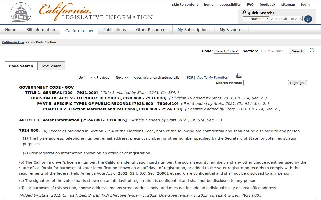
Government Code §7924.000 makes home street address, phone, email, precinct and registration identifiers, prior registration, driver-license or state-ID information, Social Security numbers, and signatures confidential except for authorized Elections Code §2194 access. The California confidentiality statute explains the protected fields used in the boundary between a public postal clue and restricted voter data.
A view of that statutory source is included because a ZIP code directory must show where the record trail stops.
An authorized county voter-data applicant must provide an original signature, a detailed approved purpose, geographic or delivery specifications, and a security plan. Email and fax applications are not accepted. Commercial use is prohibited. Aggregate district maps can describe civic geography without exposing individual voter addresses.
No Poway ZIP-Wide Resident Roll Is Verified
The central limit is simple: the reviewed Poway sources do not verify an official ZIP-wide people search. USPS verifies delivery. PowGIS identifies parcels and map context. ParcelQuest Lite supplies assessment fields. ARCC handles ownership and recorded instruments. Poway permits add project parties. Voter information has its own self and authorized-use rules. These sources can work together after an address or name is known, but a postal code does not unlock all of them at once.
For family history or a lawful civic question, preserve the evidence trail: source address, returned postal format, APN, legal description, record date, custodian, and the exact role shown. If the goal is a street-level property search, move from ZIP to address and use the PowGIS and county sequence. If the goal is one person, keep name, date, and record type aligned before accepting a match.
Use the right boundary. A postal code can narrow a mailing clue, but it cannot prove city limits, property ownership, residency, or the identity of everyone connected to an address.